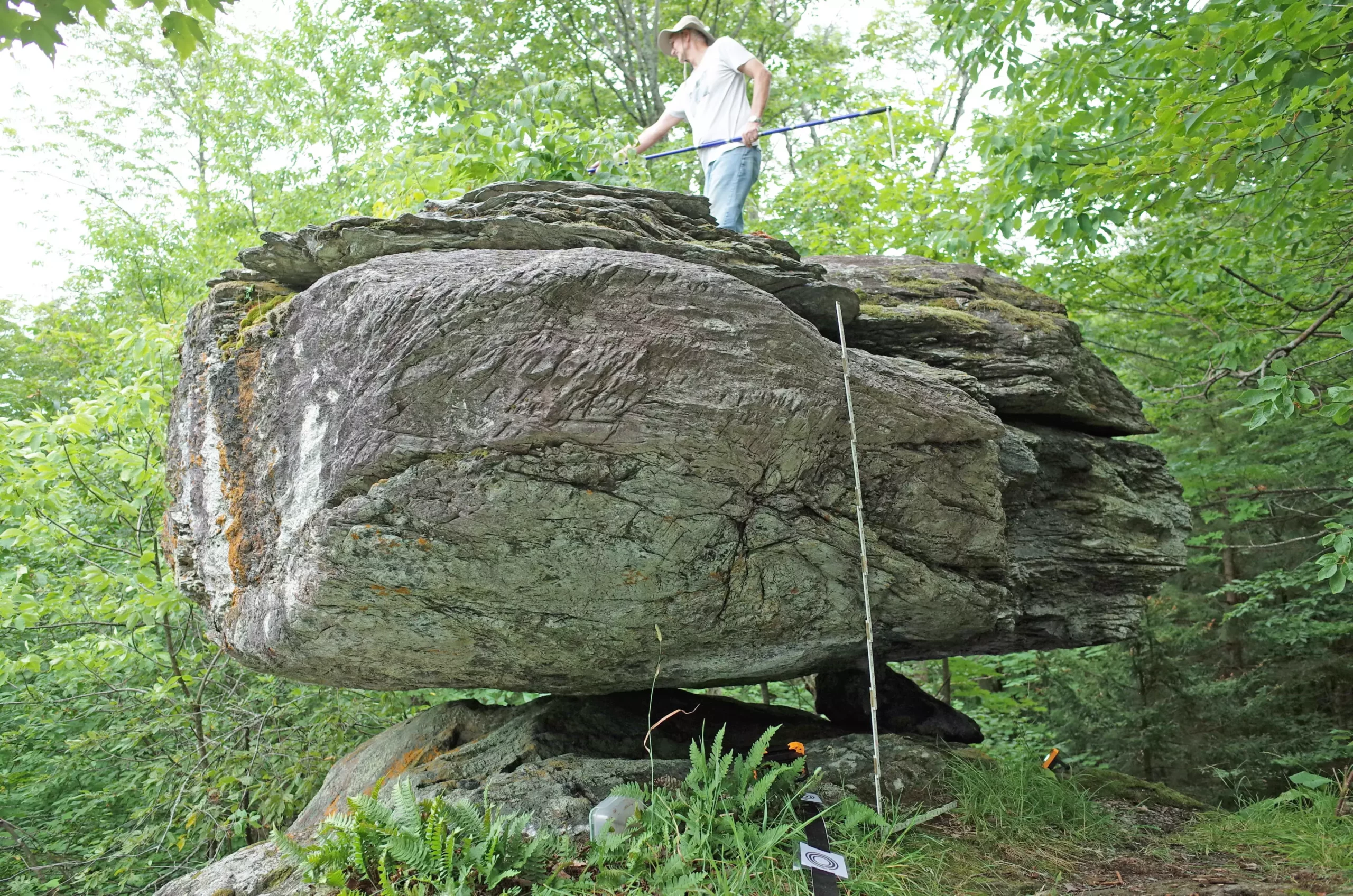
In the past, researchers have primarily relied on instrumental data and historical records to assess seismic hazard in specific regions. However, a recent study involving five precariously balanced rocks (PBRs) in New York and Vermont has introduced a novel approach to understanding long-term earthquake risk. These boulders, which were transported and left by glaciers, serve as natural indicators of seismic shaking intensity. By examining the stability of these PBRs, scientists aim to derive insights into the potential for earthquakes in areas where conventional data may be lacking.
The PBRs studied are not merely geological oddities; they are vital tools for assessing earthquake vulnerability. By analyzing their fragility—the likelihood of these rocks toppling over due to seismic activity—researchers can gauge the intensity of ground shaking needed to dislodge them from their rocky pedestals. This analysis takes into account the history of seismic activity in the region, providing a broader view of how long it has been since significant shaking has affected the area.
The findings reported in the Bulletin of the Seismological Society of America illustrate that four out of five PBRs align with the U.S. Geological Survey’s (USGS) 2023 National Seismic Hazard Model. Intriguingly, the fifth PBR situated on Blue Ridge Road in New York suggested a possible reduction in seismic hazard in nearby regions. This information suggests that particular areas in the Adirondack Mountains and the southern Lake Champlain valley might be less susceptible to large magnitude earthquakes—potentially excluding events of 7.0 magnitude or greater.
To supplement their findings, the researchers, Devin McPhillips and Thomas Pratt from the USGS, developed a map depicting the minimum distance from which an earthquake could occur without destabilizing a PBR. This innovative mapping technique parallels ongoing efforts to identify active fault lines. Prior studies in seismic zones such as New Madrid and central Virginia have utilized related geological indicators, but the focus on PBRs is a fresh and underexplored avenue in seismic science.
While the methodology has roots in similar investigations in New Zealand and Australia, McPhillips notes that interest in PBRs within Eastern U.S. geology is a relatively new development. He attributes this to the initial focus on regions with the highest seismic hazards and risks, a trend that may have overshadowed the potential for significant findings in northeastern America.
The rocks examined by McPhillips and Pratt are known as glacial erratics—massive boulders that glaciers have transported over great distances and deposited in new locations. The last glacial retreat in this region occurred approximately 15,000 to 13,000 years ago, making the boulders themselves deeply tied to the geological history of the landscape. Their precarious balance on rock pedestals shaped by glacial movement speaks volumes about past geological events.
Despite the research challenges presented by the rugged, forested terrain, collaboration with local enthusiasts and resources facilitated the identification of these fragile PBRs. The input from hiking guides and climbing forums proved invaluable, underscoring how localized knowledge can enhance scientific exploration.
To evaluate the seismic risks posed by these PBRs, the researchers employed a combination of ground-based lidar technology, on-site observations, and seismic responsiveness analysis. By meticulously defining each boulder’s characteristics—the shape, base, and contact points—McPhillips and Pratt were able to establish probabilities relating to the boulders’ toppling amid ground acceleration forces.
Their findings revealed that northern New York and northwestern Vermont present a higher seismic hazard than many other eastern U.S. areas, a fact supported by notable historical earthquake events. Among these were the 1944 Massena earthquake registering a magnitude of 5.7, and the 1983 Newcomb quake measuring 5.1. The historical backdrop provides a crucial context, further emphasizing the importance of understanding the geological and seismic risk.
McPhillips expressed optimism about the research, noting the consistency of their findings with established seismic models. By utilizing PBRs as a novel indicator of seismic intensity, this work opens doors for more comprehensive assessments in the northeastern United States. The potential for discovering additional PBRs suggests that this line of enquiry may yield even deeper insights into the region’s seismic past and future.
The utilization of precariously balanced rocks signifies a progressive step in the study of earthquakes—beyond merely documenting past events to proactively understanding the seismic landscape. As researchers continue to investigate and document these fragile geological features, essential knowledge about seismic risks in the region is likely to enhance public awareness and preparedness in the face of natural disasters.


Leave a Reply